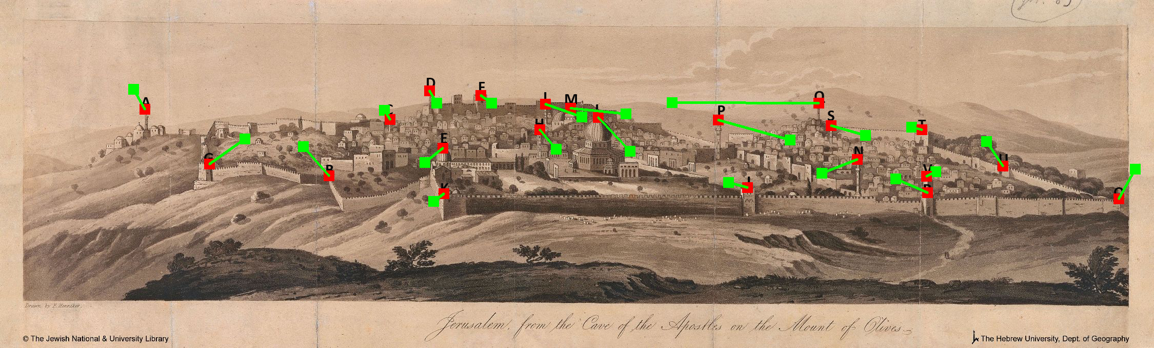
The core of the NLI (National Library of Israel) map collection include more than 1,500 antique maps and drawings of the Holy Land. This collection includes maps and drawings in European languages, Hebrew, Yiddish, and Arabic, and is a magnificent source to reconstruct ancient landscapes as well as reviving the daily life of Ottoman Palestine. So far, these sources were mostly examined qualitatively but now, with the development of Computer Vision and GIScience, they can be inspected quantitatively (temporally and spatially).
https://www.nli.org.il/en/at-your-service/who-we-are/collections/maps-collection
Our study suggests a new quantitative approaches to interpret and analyze old visual sources (e.g., drawings, maps, photographs, and air-photos) of 19th century Palestine. The study is in progress and so far, has resulted the following publications:
Researchers
Motti Zohar, PhD, Department of Geography and Environmental Studies, https://sites.google.com/geo.haifa.ac.il/motti-zohar
Ilan Shimshoni, Prof., Department of Information Science, https://is-web.hevra.haifa.ac.il/index.php/en/prof-ilan-shimshoni
Itai Roye, PhD student, Department of Geography and Environmental Studies
Tom Avikasis, MA student, Department of Geography and Environmental Studies
Liat David, MA student, Department of Computer Sciences