 The basic components of the marine ecosystem are phytoplankton, which are a diverse assemblage of photosynthetic microorganisms that form the base of the marine food web and drive approximately half of the global annual net primary productivity (Field et al., 1998). There are more than 4000 phytoplankton species that can be divided into several phytoplankton functional groups, which differ from each other in their climatic, ecological, and biogeochemical role (Litchman & Klausmeier, 2008). Yet, to date, information on how phytoplankton groups are distributed in space and time is extremely sparse, and little is known on how they affect and are affected by the changing climate
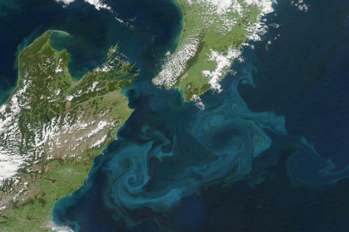
Over the last four decades, phytoplankton study has greatly benefited from the use of satellite imagery, which allows quantitative surveys of phytoplankton biomass spatio-temporal patterns. Such surveys involve global measurements of surface concentrations of chlorophyll – a pigment found in phytoplankton cells that is used as a proxy for phytoplankton biomass. The spatial organization of the chlorophyll fields at the submesoscale (10 to 100 km) is affected to first-order, by ocean turbulence. However, phytoplankton are not passive tracers, and their spatial organization depends on their response to physical and chemical forcings. Disentangling the spatial organizations of chlorophyll relative to a passive tracer such as sea-surface temperature can, therefore, carry information on phytoplankton biological response to their environment.
In this project, we explore whether it is possible to extract information on phytoplankton group distribution from the spatial organization of the chlorophyll fields. To achieve this goal, we use high-resolution (1×1 km) data of surface chlorophyll and sea-surface temperature from the Moderate Resolution Imaging Spectroradiometer (MODIS) satellite, and use image-analysis and machine-learning tools. The outcome of this project is biological information on phytoplankton traits retrieved from satellite images. This will advance our theoretical and predictive understanding on phytoplankton biogeography, and their biogeochemical role.